
Maps
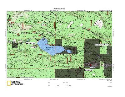
These are two neat trails around the lake.
These maps are a combo of topo maps, Forest Service road maps, and show the most current status of the roads.
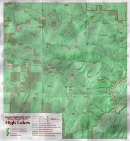
Older LNF map of the High Lakes
Hard to find these anymore. They used to be posted at the entrance to the High Lakes.
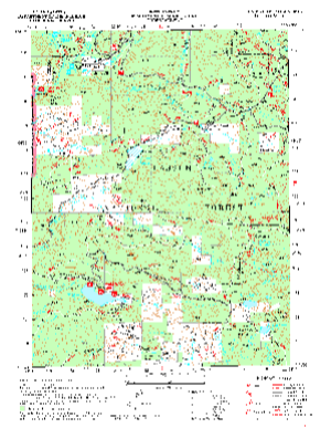
Lassen National Forest Quad Maps
These maps are a combo of topo maps, Forest Service road maps, and show the most current status of the roads.
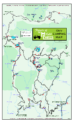
Friends of The High Lakes OHV Camping Map
This is currently the best map of the High Lakes. It is the high resolution version. To resize/print it, right-click on the image, do a Save-As, and save it to your computer. Then open it with your picture management software. It should be able to resize it to the paper size you want.